In the space of two days, a family pet’s ordeal distilled a modern truth about wilderness rescue: the best outcomes increasingly come from old-fashioned grit fused with just enough technology to narrow an otherwise impossible search.
The Short Version
- A four-year-old poodle–husky mix, LouLou, survived roughly 50 hours alone after an avalanche in Alaska’s Chugach State Park.
- Two mountaineers were swept about 500 feet off a ridge; LouLou was separated and vanished into deep snow.
- Volunteers, a helicopter and drone passes, and intermittent pings from the dog’s AirTag ultimately converged to locate her alive.
- The case illustrates how consumer trackers can focus a search in austere terrain—useful, but not a substitute for trained people and aircraft.
What happened: an avalanche, a separation, and an against-the-odds find
The core facts are clear and consistent across outlets: on October 10, in Alaska’s Chugach State Park near Eklutna Lake, two experienced mountaineers and a four-year-old poodle–husky mix named LouLou were hit by an avalanche. The slide swept the men about 500 feet off a ridge; they survived and were rescued, but the dog disappeared into the winter backcountry. Roughly 50 hours later, searchers found LouLou alive, largely uninjured, and alert—an outcome that is rare enough to be notable and specific enough in timing and location to carry the ring of a well-documented field rescue.
The search was not a single tactic affair. Accounts describe a familiar, layered response: volunteers organized grid sweeps where terrain allowed, aerial teams used a helicopter and drones to cover more ground, and a thread of digital breadcrumbs—location updates from the AirTag attached to LouLou’s collar—periodically tightened the search box. That combination produced the break. While the AirTag did not behave like a live GPS beacon, it provided intermittent fixes that, together with human judgment and air support, guided rescuers to the right slope at the right time.
How AirTags actually help in the wilderness (and where they don’t)
AirTags are not satellite trackers; they ride on Apple’s “Find My” mesh, which means a tag’s location updates only when a nearby iPhone or compatible device hears it and relays a timestamped position. In a city that can feel like continuous tracking. In alpine terrain, it becomes episodic: a hiker passes a trail junction, a ski patrol phone on a training day rolls through a drainage, a helicopter crew’s device comes within range—and the network registers a new pin. The result is not a breadcrumb trail but a series of dots that, in aggregate, can steer a search team toward a promising sector faster than blind sweeps would allow.
That environmental dependency matters. Accuracy varies widely with device density and proximity; precision finding works at short range via ultra-wideband, but in true backcountry you are usually operating on stale or coarse fixes—useful for narrowing a valley, not for pointing to a snow hollow behind a krummholz stand. The Alaska rescue underscores the right mental model: treat a consumer tracker as a coarse cue generator that can shrink the map, then rely on trained people, aircraft, radios, and methodical search patterns to close the last mile safely.
Avalanche physiology and why LouLou’s survival is remarkable
Avalanches kill via two principal mechanisms: trauma from the slide itself and asphyxia during burial. For fully buried humans, the survival window is typically measured in minutes—often cited around 15—because snow compacts, oxygen drops, and carbon dioxide rises quickly. Variables like burial depth, the presence of an air pocket, and rapid excavation by companions dominate outcomes. Dogs are not people, but the physics are indifferent; prolonged survival following an avalanche generally implies the subject was not fully buried or found a niche with adequate ventilation, escaped burial zones, or migrated downslope to safer microterrain after the slide released.
That is almost certainly what happened here. Reports indicate the mountaineers were displaced by roughly 500 feet and recovered, while LouLou was separated and unaccounted for. Her discovery after about 50 hours, apparently alert and largely uninjured, points toward minimal burial—perhaps she was carried beyond the main debris field or self-extricated quickly—followed by a period of exposure survival in subfreezing, snowy conditions. That combination is unusual but plausible, and it aligns with the pattern of animal resilience coupled with a search that never devolved into random wandering; each AirTag ping kept rescuers focused on the right massif rather than starting over each morning.
Inside the search: layering tactics to convert clues into a find
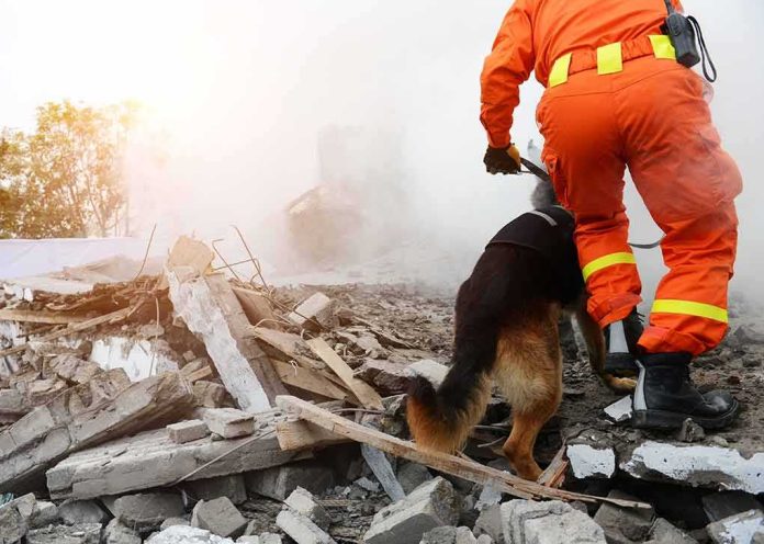
Effective wilderness searches begin by bounding the problem. Rescuers establish a last known point, a probable direction of travel, and terrain traps—gullies, benches, tree wells—where a subject might be. In this case, the avalanche path and ridge line created a natural frame. Air operations covered inaccessible bowls and ridges quickly; drones probed snow surfaces and glides from safe standoff distances; ground teams advanced deliberately through areas the aircraft could not interrogate well. Periodic AirTag hits—likely triggered when aircraft or other devices entered range—refined the sectors to prioritize next. None of these tools alone would have been sufficient. Together, they created a feedback loop: cue, investigate, adjust, and repeat until the subject was found.
It is worth emphasizing what did not happen. There was no single, continuous digital track leading rescuers straight to LouLou, and no claim that consumer tech replaced established avalanche rescue doctrine. Rather, a modest, environment-limited signal shaved hours off a search that still depended on trained eyes, safe route-finding, and aviation assets to succeed under winter constraints. That is the realistic standard for integrating everyday tech into backcountry response.
solana:7BMb4jNt2tQG81jX7W22H2h2UyL4SW9QJgz25HRhpump 200K
2N8c4pXu6T2oBxE8ZDBYb3QgwMkyTe673HiBaYSNpumpOn October 10, LouLou followed two climbers into Chugach State Park in Alaska. During the trip, they were caught in an avalanche. The two climbers were swept about 500 feet down… https://t.co/KPRpRzCDRC pic.twitter.com/hqeQA3tqk9
— Azzie (@Motier_crypto) October 13, 2026
What this means for backcountry travelers and pet owners
For those who hike and ski with dogs, LouLou’s rescue argues for a layered preparedness mindset. A collar-based tracker adds value by helping rescuers draw a tighter circle on the map—especially when aircraft, patrollers, or other parties are likely to pass within Bluetooth range. But it should sit alongside fundamentals: winter training for humans, leashes or harnesses where terrain demands control, canine insulation and booties in deep cold, and, for avalanche terrain, a conservative travel plan that treats dog management as an integral part of hazard mitigation rather than an afterthought. A tracker is a supplement to good judgment, not a hedge against its absence.
A durable lesson: resilience, plus signal, plus systems
The heart of this story is not that technology saved the day; it’s that a resilient animal, a community of responders, and a small but critical signal combined to turn a sprawling, snow-covered search area into a solvable problem. In austere environments, that is the formula that endures. Consumer networks will wax and wane with coverage; aviation and volunteer capacity will vary by region; avalanche seasons come and go. The discipline that binds them—triaging cues, integrating assets, and persisting intelligently—travels anywhere. LouLou’s 50 hours in the Alaska backcountry remind us that modern rescue is rarely about a single hero or device; it’s about stacking advantages until chance becomes outcome.
Sources:
people.com, lastampa.it, tag24.de, ilfattoquotidiano.it, pcmag.com, hotairtag.com, greenlight.com, hubble.com, seattletimes.com